Directory of memorials to war dead and war gravesites
The Brandenburg register of memorials to fallen soldiers and war gravesites is an open project of the Brandenburg Genealogical Society "Roter Adler" e.V. Not only members of the society but also all other interested parties can participate. In this project, which is affiliated to the cemeteries as well as to the villages, monuments for fallen soldiers as well as war gravesites and the data to be found on them are to be recorded. It does not matter whether they are located in a cemetery or any other place in the village.
Each sender of data can decide for himself whether the transcripts are to be displayed completely publicly or only as an index of names. The symbols behind the war memorials and war gravesites have the following meaning: The transcripts for these entries can be viewed completely publicly./em>
 Information on these fallen soldiers or graves can be requested by e-mail
Currently this directory contains information on 1188 war memorials and war gravesites.
Freienwalde / Bad Freienwalde 1870/71
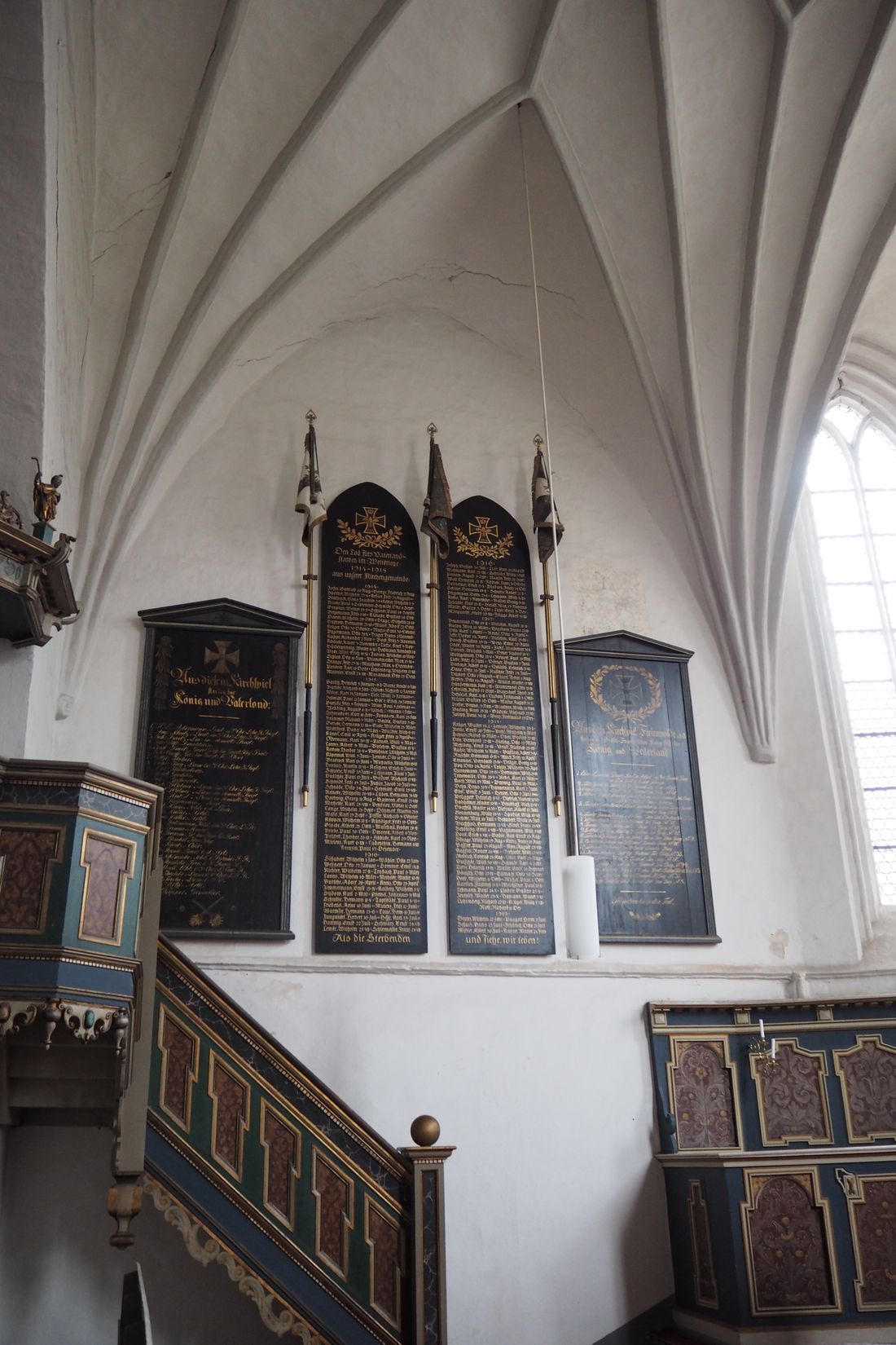 Photographer: Astrid Burkhardt 2016 | Place | Freienwalde / Bad Freienwalde 1870/71 |
| District | Landkreis Märkisch-Oderland | |
| GOV-ID | FRELDEJO72AS | |
| Belongs to cemetery | ||
 Photographer: | Belongs to church | St. Nikolai Kirche Bad Freienwalde |
| Longitude and latitude | °O °N | |
| Numbber of fallen | 18 | |
| Remarks | rechte Tafel in der Kirche. Inschrift: Aus dem Kirchspiel Freienwalde a.d.O. starben im Deutsch-Französischen Kriege 1870/71 für König und Vaterland | |
| Entry 1 to 18 of 18 entries | ||||
| Lastname | Firstname | |
| Daum, von | Erich |
| Göttel | Theodor |
| Grieben | Fritz |
| Helwig | Gottlieb |
| Kramer | Friedrich |
| Lange | Eugen |
| Lange | Christian |
| Mielecke | Friedrich |
| Mielenz | Julius |
| Peter | Carl |
| Polle | Theodor |
| Ramm | Theodor |
| Reetz | Wilhelm |
| Rilke | Carl |
| Schrader | Herm. |
| Schulz | Arthur |
| Sperling | August |
| Zaertler | Wilhelm |
Verein für Computergenealogie e.V.
| Name: | |
| GOV-ID: | FRELDEJO72AS |
| Longitude and Latitude: | 14.05932942029 °O 52.811480869565 °N |
| Height over NN |
Back to overview